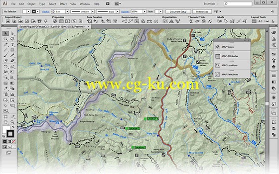
Avenza MAPublisher for Adobe Illustrator v9.8.1 win mac
这是一款地图设计出版插件,是 Avenza 公司针对 Adobe illustrator
所提供的插件,它为地理信息系统的数据与高端图形设计、电子地图高分辨率打印、地图电子出版架起了桥梁。MAPublisher 将 GIS
的数据特点与 Adobe illustrator 的强大设计环境相结合,使本地的 GIS
数据作为地图生产的基础数据。而不再需要扫描和跟踪数据。MAPublisher 支持大多数 GIS 格式的输入,包括
ESRI,Mapinform,Microstation,AutoCAD 和 USGS。所有输入的 GIS
数据的属性和图形参数在制图过程中都能存取和编辑。
Mapping solutions for the 21st century®
Finally, high-quality map production software that works. MAPublisher® cartography software seamlessly integrates over fifty GIS mapping tools into the Adobe Illustrator environment to help you create maps the way you want, how you want.
Import the most widely used GIS data formats, including those from Esri, MapInfo, FME Desktop, AutoCAD, Google and the U.S. Government. Export data to a wide variety of standard GIS formats including the ability to export documents to geospatial PDF and take them mobile with the Avenza Maps app. See all MAPublisher supported formats.
All GIS data attributes and geographic parameters are maintained and editable. Use MAPublisher tools to create, query, and select features and attributes.
MAPublisher supports Esri ArcGIS 10 geodatabases and ArcMap document (MXD) files*. Connect to Personal, File and ArcSDE geodatabases with ease. Learn more about geodatabase support in MAPublisher.
Cartography with MAPublisher is now faster, easier, and better than it has ever been. When used together with Geographic Imager for Adobe Photoshop, they form the perfect vector and raster map creation software package for the Adobe Creative Cloud and Suite.

发布日期: 2016-10-21