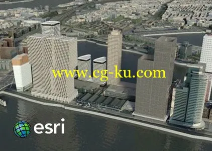
Esri CityEngine是三维城市建模的首选软件,应用于数字城市、城市规划、轨道交通、电力、管线、建筑、国防、仿真、游戏开发和电影制作等领域。
CityEngine Esri is the first choice for 3D city modeling, applied in Digital City, urban planning, rail transportation, power, pipeline, construction, national defense, simulation, game development and film production and other fields.
Esri CityEngine可以利用二维数据快速创建三维场景,并能高效的进行规划设计。而且对ArcGIS的完美支持,使很多已有的基础GIS数据不需转换即可迅速实现三维建模,减少了系统再投资的成本,也缩短了三维GIS系统的建设周期。
CityEngine Esri can use 2D data to create 3D scene quickly, and can carry out planning and design efficiently. And the perfect support for ArcGIS, so that a lot of basic GIS data can not be converted to quickly achieve three-dimensional modeling, reducing the cost of system re investment, but also shorten the construction period of three-dimensional GIS system.
ESRI CityEngine Advance 2015.x | 408.6 mb
Esri has released update of CityEngine Advance 2015, the latest version of its advanced 3D GIS urban design software. CityEngine generates detailed city models from simple procedural rules, importing and exporting data in standard file formats, including OBJ, 3DS and DXF.vThe new release includes dynamic new features and enhancements.
The release of Esri CityEngine 2015 allows GIS professionals, architects, planners, and urban designers to create 3D city models faster and share them easily via ArcGIS Online. These new features open the use of 3D models for every day, real-world simulation, emergency response, urban planning, and entertainment scenarios.
Companies like Esri partner SmarterBetterCities use CityEngine to help clients view and investigate building development proposals in a true 3D environment.
Advancements from user requests—including a modern editor for managing layers, real-time shadows based on daytime and location, faster data export, and improved publishing workflows—have been implemented. More information can be found in therelease notes
About Esri
Esri inspires and enables people to positively impact their future through a deeper, geographic understanding of the changing world around them. Esri has cultivated collaborative relationships with partners who share our commitment to solving Earth’s most pressing challenges with geographic expertise and rational resolve.
Esri pursues mapping and spatial analysis for understanding our world with visionary products and services that define the science of GIS. ArcGIS is a complete system for designing and managing solutions through the application of geographic knowledge. Esri helps you build and manage great information products by providing the ultimate platform for geospatial integration and application.
Name: ESRI CityEngine Advance
Version: (64bit) 2015.1.2047
Home: http://www.esri.com
Interface: english
OS: Windows XP / Vista / 7even / 8 / 8.1
Size: 408.6 mb
ESRI CityEngine 推进 2015.x |408.6 mb
Esri 已发布的 CityEngine 提前到 2015 年,其先进的三维地理信息系统城市设计软件最新版本的更新。CityEngine 从简单的程序规则,生成详细的城市模型导入和导出标准文件格式的数据,包括 OBJ,3DS 和 DXF.vThe 的新版本包括动态的新功能和增强功能。
Esri CityEngine 2015 年版本允许 GIS 专业人士、 建筑师、 规划师和城市设计师来更快地创建三维城市模型和分享他们很容易通过 ArcGIS 在线。这些新功能打开 3D 模型用于每一天、 真实世界模拟、 应急、 城市规划和娱乐方案。
像 Esri 合作伙伴 SmarterBetterCities 公司使用 CityEngine 来帮助客户查看,并探讨建立一个真正的 3D 环境的发展建议。
从用户请求的进步 — — 包括管理层的现代编辑器,实时阴影基于白天和位置、 速度更快的数据导出和改进出版工作流 — — 得到执行。更多的信息可以发现在生物制品笔记
关于 Esri
Esri 激发,使人们对他们通过更深层次、 地理的理解他们周围不断变化的世界的未来产生积极的影响。Esri 培养了与人分享我们致力于解决与地理知识和理性解决地球的最紧迫的挑战的伙伴合作关系。
Esri 追求制图和空间分析对于理解我们的世界与有远见的产品和服务,地理信息系统的科学定义。ArcGIS 是一个完整的系统设计和管理解决方案通过地理知识的应用。Esri 可帮助您构建并管理大量的信息产品提供地理空间集成和应用程序最终平台。
名称: ESRI CityEngine 提前
版本: (64 位) 2015.1.2047
主页: http://www.esri.com
接口: 英语
操作系统: Windows XP / Vista / 7even / 8 / 8.1
大小: 408.6 mb