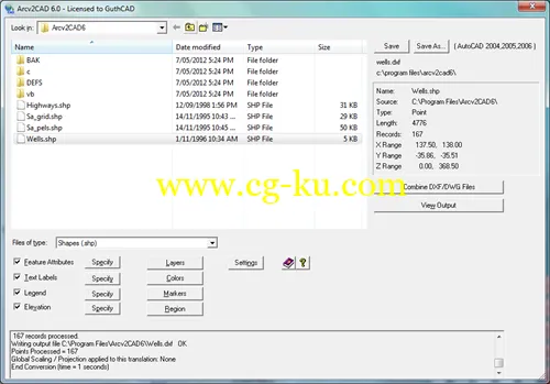
Arcv2CAD 能将ArcView / ESRI shapefile文件转换为AutoCAD的DXF/DWG文件,这使得所有的CAD软件可以读取shapefiles文件,例如AutoCAD,MicroStation, CivilCAD, DesignCAD, Visio以及CorelDraw, Surfer, World Construction Set之类的绘图软件
Arcv2CAD v7.0 A.02 | 18 Mb
Arcv2CAD 7.0 converts ESRI shapefiles (ArcView, ArcGIS, ArcMap etc.) to AutoCAD DXF and DWG formats. This allows shapefiles to be read by virtually all CAD software, for example AutoCAD, MicroStation, CivilCAD, DesignCAD, SolidWorks, as well as numerous other Mapping and Graphics software, eg CorelDraw, Surfer, World Construction Set.
Features
Apply Colors corresponding to selected Feature Attributes.
Output entities onto Layers corresponding to Feature Attributes.
Color fill Polygons - correctly handles holes.
Produce Text Labels from Features data. Powerful built in Auto-Label function.
Transfer table data via DXF/DWG ATTRIB or Extended Data (XData) definitions.
Output Elevation data as real 3D Z coordinates.
Command line mode for batch operation.
Standalone converter, does not require ArcView, ArcGIS, ArcMap, etc.
Output of a Legend
Translate to all of AutoCAD DXF and DWG versions up to the latest 2014. New
Support for all 3D shapefile types (PointZ, PolylineZ, PolyGonZ, MultiPatch, etc)
Data source may be CSV or DBF (i.e. no shapefile, simply a points database)
Optionally output to CSV
Properties control for attributes (ATTRIBs), i.e. size, position, color, etc.
Named Marker Blocks more...
Extrude 2D Polygon shapes to 3D Objects. Picture
Online context sensitive help
Fully handles the latest 3D shapefiles.
Compatible with all ArcGIS / ArcMap/ ArcView / ... products (all versions.)
Support direct access to shapefiles in ESRI Personal Geodatabase files. New
New in Version 7.0:
Output all DXF and DWG formats up to AutoCAD 2014
Support direct access to shapefiles in ESRI Personal Geodatabase files.