ArcGIS Explorer Desktop是一个由ArcGIS for Server提供强大支持的新的空间信息浏览器;它提供一种快速并且使用简单的方式浏览地理信息,无论是2D还是3D的信息;并提供了强大的对数据的查询和分析任务。
ArcGIS Explorer Desktop是通过访问ArcGIS for Server提供的强大的完整的GIS功能,整合了GIS数据集与基于服务器的空间处理功能,提供了空间处理和3D服务。ArcGIS Explorer Desktop是也可以使用本地数据和ArcIMS的服务,ArcWeb Services,OGC WMS和KML,具有开发性和互操作能力。ArcGIS Explorer Desktop是可以被任何个人和专业人员下载和使用。
通过ArcGIS Explorer Desktop是,我们可以:
无缝的以2D和3D方式浏览整个世界的数据
集成本地数据以及来自ArcGIS for Server,ArcIMS的服务和数据,OGC WMS或ArcWeb Services
通过任务进行GIS分析,如可视化分析,建模,邻域查找和统计分析
以地图的方式回答跟地理相关的问题,并与他人共享你的结果
使用自有的服务器上的数据和地图,并与其他服务器上的数据联合使用
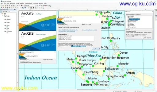
ESRI ArcGIS Desktop 10.7.1 with Data Interoperability | 2.2 Gb
ESRI is pleased to announce the availability of ArcGIS Desktop 10.7.1. This release is primarily a quality improvement release, and bug fixes that improve the 10.7 release.
ArcGIS
is a platform for organizations to create, manage, share, and analyze spatial data. It consists of server components, mobile and desktop applications, and developer tools. This platform can be deployed on-premises or in the cloud (Amazon, Azure) with ArcGIS Enterprise, or used via ArcGIS Online which is hosted and managed by Esri.
ArcGIS Desktop
is the key to realizing the advantage of location awareness. Collect and manage data, create professional maps, perform traditional and advanced spatial analysis, and solve real problems. Make a difference and add tangible value for your organization, your community, and the world.
ArcGIS Pro and ArcMap are part of ArcGIS Desktop suite and allow users to publish and manage data and maps in conjunction with ArcGIS Online and ArcGIS Enterprise. These desktop tools also excel at detailed and sophisticated analysis and can be extended and scripted with various tools.
Esri
is the global market leader in geographic information system (GIS) technology, location intelligence, mapping software, and spatial analytics. Esri software is deployed in more than 350,000 organizations and 75 percent of Fortune 500 companies. The world’s largest cities, most national governments, and more than 7,000 colleges and universities use Esri technology to improve operational and business results. Since 1969, Esri has helped customers unlock the full potential of data with its pioneering commitment to geospatial information technology. Esri builds ArcGIS, the world’s most powerful geospatial cloud platform, and engineers the most advanced solutions for digital transformation, the Internet of Things (IoT), and advanced analytics.
Product:
ESRI ArcGIS Desktop
Version:
10.7.1 with Data Interoperability
Supported Architectures:
x64
Language:
english
System Requirements:
PC *
Supported Operating Systems:
*
Size:
2.2 Gb


发布日期: 2020-03-06