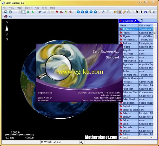
一款交互式的、立体的地表地理信息浏览器。可看到全球的地理地貌及其详细信息。另外,你只要选择好方位或地名,就能计算出两点之间的距离。看到关于某个国家的概况,城市信息、海岸线、岛屿、湖泊、河流、国界线。还提供实时在线的经纬度指示。适用于教育和科研领域。
Motherplanet Earth Explorer 6.1 | 11.5 MB
Earth Explorer 6.1 is GPS Enabled digital map software with high-resolution satellite imagery, shaded relief topographic imagery and blending imagery of the two. It also include location information of 270 countries and regions, 50000+ cities, 15000+ islands and 50000+ earthquakes from 1973; And outline information of political boundaries, rivers, lakes, coastlines of the world and etc. All those map information was integrated together for providing a total 3D view of our beautiful planet earth. You can place your own placemarks and path routes to the map, show GPS tracks on the map and keep them with the maps if you connected with a GPS device. Beside these, it has many other interesting functions, you can regard it is a kind of educational scientific software of geography.
Feature List:
1. Realtime satellite map GPS tracking on vehicle/ship/plane;
2. 30m-res satellite image(Landsat7) and 90m-res SRTM picture exploring in online/offline mode;
3. Include information of 270 countries and regions, 40000+ cities, 15000+ islands, 50000+ earthquakes from 1973 and vector layers includes political boundaries, coastlines, rivers, lakes, longitude-latitude grids;
4. User can add their own Placemarks, Paths, GPS Tracks to Earth Explorer;
5. User can define and add their own map style to Earth Explorer;
6. Support NMEA-0183 compatible GPS receiver;
7. Other functions like Measure and calculate distance and bearing between any two location, find by name, show day/night shadow effect, adjust Gamma, and etc.
8. Download maps to disk cache in background (Advanced license).

OS :
Windows ME, Windows NT, Windows 2000, Windows XP, Windows Vista, Win 7
Language
: English
Home Page
-
http://www.motherplanet.com/
发布日期: 2014-03-16