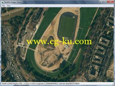
Microsoft Virtual Earth Satellite Downloader是一款微软Virtual Earth地图下载软件,通过自定义经度和纬度范围,使用多线程来下载指定范围内的卫星地图。可以自定义地图放缩级别,另外该软件自带了地图合并工具与地 图查看器,可以方便的管理和查看你的地形图文件。
当Google Earth仍然是无可争议的重量级全球测绘工具,微软已经悄然开始在这方面做出巨大努力。而且效果不错,商业的竞争对于用户来说,有时也是件好事。 Microsoft Virtual Earth结合了包含航拍照片,地图,黄页数据等,但是主要显示的周围的地图和空中的观察情景。你可以对地图进行放大或缩小,并拖动图片,以满足不同的观 察效果。空中拍摄的照片是用标签覆盖,用来显示街道名称,标志等。
Virtual Earth主要以3D模式显示所搜索的区域,当搜索不同地方或“拖动”区域,会有一种在空中漂浮的感觉。它对地形的显示还是比较完整和真实的。
Allallsoft Microsoft VirtualEarth Satellite Downloader | 1.6 Mb
Microsoft VirtualEarth Satellite Downloader is a cute tool that help you to get small tile satellite images from Microsoft VirtualEarth. All downloaded small images are saved on the disk. You can view downloaded maps by Satellite Viewer Or you can combine them into a big BMP map. It supports proxy server. And you can easily get the longitude and latitude of each downloaded small tile image.
Home Page
-
http://www.allallsoft.com/mvsd/
Allallsoft Microsoft VirtualEarth Satellite Downloader 8.0
发布日期: 2014-05-28