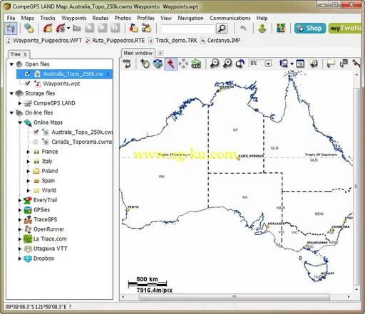
CompeGPS是一款利用GPS系统分析陆地路线的应用软件。通过CompeGPS,可以在Internet上下载各种图表,并且分析你所需要的路线。
CompeGPS LAND 7.x | 37.5 MB
CompeGPS Land is the software that will let you take the most of your outdoor trips. Its great variety of preparing, navigating and analysing tools is the perfect basis for any amateur or professional of outoor sports (trekking, mountain or racing bike, 4X4, skiing, etc.) to obtain the best efficiency and loads of fun.
Maps
Use every all types of maps: topographic, vectorial, satellite pictures, free online maps... you will be able to open the most common formats (.ecw, *.bmp, *kmz, *.jpg, *.tif, *.tiff, *.png...). Create vectorial maps or even scan and calibrate your own maps.
Tracks, routes and waypoints
Create tracks, routes and waypoints by just a few clicks, edit and add stages for several days trips. Analyse them with plenty of data, graphics, etc. Save and classify your tracks by activities, distance, slope, etc.
Communication
Plug&Play communication with TwoNav devices (Sotware and GPS). Send/load maps, tracks, routes and waypoints directly from the software’s data tree. Compatible with other GPS (Garmin, Magellan...).
Live data
Add a GPS receiver to your PC (not included) and access to live Data to get plenty of information during the navigation: speed, altitude, time to arrival...
3D View
The most realistic and spectacular perspective of your past and future trips.
Pictures
Synchronise every pictures you took during your trip and place them on the map, exactly at the right place.

OS :
Windows XP/Vista/7/8
Language
: English
Home Page
-
http://www.compegps.com/
发布日期: 2016-01-29