CAD2Shape将AutoCAD® DXF或DWG格式转换为ESRIShapefiles((ArcGIS®, ArcMap, ArcView等)。
完全独立(不需要AutoCAD®,ArcGIS®, ArcMap)。
将DWG转换为SHP(或将DXF转换为SHP)的简单4个步骤选择输出形状文件类型,例如MultiPatch、2D/3D多边形、Polyline、Point、Text Labels。
支持所有AutoCADDWG/DXF版本,包括AutoCAD 2020。
批量转换并将CAD层导出到Shapefile。
其他投射,如Gauss-Kruger,SIRGAS。
English | File size: 30.2 MBCAD2Shape is a program with a pretty self-explanatory name – it allows you to convert AutoCAD documents (DXF and DWG) to the ESRI shapefile format (SHP, supported by apps like ArcView, ArcGIS and ArcMap), as well as to Surfer Blanking (BLN) and XYZ.
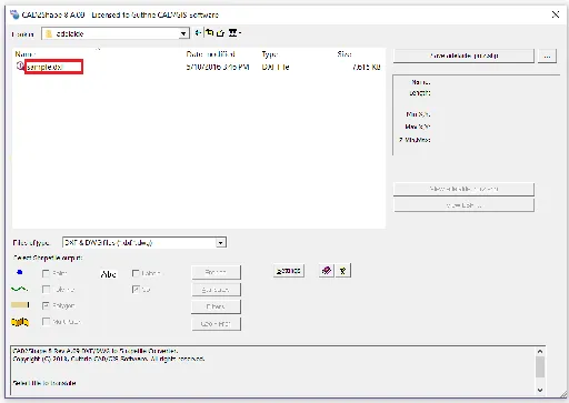
The interface of the tool is based on a standard layout where you can use the file browser to locate and select items for processing.
Unfortunately, working with multiple items at the same time is not possible.
So, you can check out the name, date of modification, type and size for each file in the list.
If you prefer the default settings, then all you have to do is specify the output destination and filename, in order to proceed with the conversion procedure.
Otherwise, you can select the type of objects to convert, from points, polylines and polygons to MultiPatch, labels and 3D.
Experienced users can configure additional entity settings (e.
g.
circle, circle center points, eliminate identical point) and select common entity attributes to convert (e.
g.
ID, LAYER, COLOR, LINEWEIGHT), as well as filter settings (layers, pens, region).
From the ‘Settings’ area you can make CAD2Shape close Polylines and output UCS coordinates, apply an offset for the coordinates, as well as select the units, base and direction for the rotation, and others…….
.
