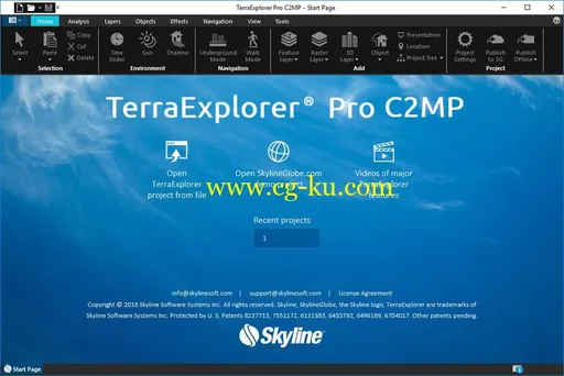
一款尖端的3D GIS桌面查看器和创建器,可提供功能强大的工具和高分辨率3D环境,可用于查看,查询,分析和显示地理空间数据。
借助TerraExplorer强大而广泛的功能,可以通过使用无限数据层,3D模型,虚拟对象等覆盖地形来创建逼真的3D可视化。
分析:除了用于距离,斜率和体积测量的基本测量和分析工具外,TerraExplorer还具有先进的功能,包括3D平面面积测量,图像比较和动态3D视图。
显示:可以在地形上覆盖无限大小和分辨率的多种格式的图像和高程图层,并与要素图层和多分辨率,流优化的3D网格模型图层无缝集成,以便于3D地理空间的可视化,访问和分析数据。
空间查询:TerraExplorer提供了操作特征和3DML数据以及分析空间关系的高级功能。
可以对图层的要素执行各种空间操作,包括将要素合并到单个要素中,将一个多边形复制到另一个要素,将多部分要素展开为其各个要素要素,以及将所选要素导出到新文件。
支持复杂的空间和属性查询。
可以基于属性值或基于它们与指定多边形,线点或对象的空间关系来过滤特征。
可以定义缓冲区以包括选择的特定半径内的特征。
发布数据:SkylineGlobe Server简化了TerraExplorer工作流程,使整个项目和图层得以优化,并直接从TerraExplorer Pro发布到云服务器。
通过单一发布操作,数据可供所有TerraExplorer客户端使用:Desktop,Mobile和TE for Web,以及标准地理空间客户端,如WFS / WFS-T / WMS / WMTS / 3D Tiles(Cesium)。
创建和共享3D演示文稿:借助TerraExplorer的演示工具,您可以创建演示文稿,通过将自定义航班路线与项目的特定显示相结合,您可以在其中传达3D世界的特定视图。
您的演示文稿包含一个或多个步骤,您可以在每个步骤中控制3D世界的显示,包括当前摄像机位置,图层和对象可见性,系统时间以及弹出消息和标题。
演示文稿可以轻松转换为标准视频文件。
File size: 99 MBTerraExplorer is a cutting-edge 3D GIS desktop viewer and creator that provides powerful tools and a high resolution 3D environment in which to view, query, analyze and present geospatial data.
With TerraExplorer’s robust and extensive capabilities, realistic 3D visualizations can be created by overlaying the terrain with unlimited data layers, 3D models, virtual objects and more.
AnalysisIn addition to basic measurement and analysis tools for distance, slope, and volume measurements, TerraExplorer features advanced capabilities, including 3D plane area measurement, imagery comparison, and dynamic 3D viewshed.
DisplayImagery and elevation layers of unlimited size and resolution in a wide range of formats can be overlaid on the terrain and seamlessly integrated with feature layers and multi-resolution, stream-optimized 3D mesh model layers for easy visualization, access, and analysis of 3D geospatial data. If a new layer is based on a source that uses a different coordinate system, the layer can be reprojected to the project’s coordinate system. Point, line and polygon features can be displayed and used to display advanced layer information based on their attribute data. TerraExplorer also includes an extensive set of objects: 2D and 3D, dynamic, buildings, models, point cloud models and video, that can be displayed on the terrain, as well asadvanced terrain objects that allow terrain modification within TerraExplorer Pro.
A flexible clipboard mechanism and sophisticated duplication tools make it easy to copy, paste, and position objects on the terrain.
Realism is enhanced with environment settings that include lighting effects, horizon distance, fog color, sky texture, cloud display, and shadow color.
TerraExplorer ViewerUsers can navigate through and perform advanced terrain analysis and basic editing of high resolution 3D world environments created by fusing aerial and satellite photography, terrain elevation data and other 2D and 3D information layers.
TerraExplorer PlusAdds loading of all 2D and 3D offline formats, feature layer editing and querying, advanced objects and drawing tools, a set of tools for professional usage, and the advanced Pro API interfaces.
TerraExplorer ProAdds publishing capabilities as well as uploading of data to SkylineGlobe cloud.
New Features in Release 7.0.2Support for Cesium 3D Tiles (B3DM)TerraExplorer 7.0.2 expands 3DML support to include the loading of mesh layers in Cesium 3D Tiles(B3DM) format.
Reproject 3DML Elevation ValuesNew option to reproject the elevation values of 3DML layers.
New Supported Formats Load feature layers from Open Street Map – TerraExplorer 7.0.2 extends feature layer support toinclude Open Street Map (OSM) datasets.
User interface for WCS – TerraExplorer 7.0.2 provides a user interface for loading elevation layersfrom Web Coverage Servers.
3DML Style by Attribute3DML’s loaded with classification layers with attribute fields can be styled based on the attribute fieldvalues of the classification polygons.
