涓栫晫鏀挎不鍦板浘娓告垙鍦烘櫙宸ュ叿Unity娓告垙绱犳潗璧勬簮.rar (129.02 MB)
本游戏资料是个关于世界政治地图游戏场景工具Unity游戏素材资源,大小:130KB ,格式:unitypackage,使用软件:Unity,供广大设计师学习使用,语言:英语。
Unity3D是一个让你轻松创作的多平台的游戏开发工具,是一个全面整合的专业游戏引擎。Unity代表了一个质的飞跃——内置的光照贴图(lightmapping)、遮挡剔除(occlusion culling)和调试器。编辑器经过彻底革新,让你可以获得卓越的性能体验。不可思议、无法阻挡的产品已经看到了曙光。
Unity是一款跨平台的游戏开发工具,从一开始就被设计成易于使用的产品。作为一个完全集成的专业级应用,Unity还包含了价值数百万美元的功能强大的游戏引擎。Unity作为一个游戏开发工具,它的设计主旨就是让你能够创建令人惊讶的游戏。如果你之前尝试过Unity,请查看Unity都做了哪些更新。如果你是第一次尝试,那就好好看看吧,看Unity都能为你带来什么。Unity作为一种开发环境,可让你脱离传统的游戏开发方式,以一种更简单的方式专注于你的游戏开发。开发网络游戏、移动游戏、单机游戏,Unity都能完全胜任。
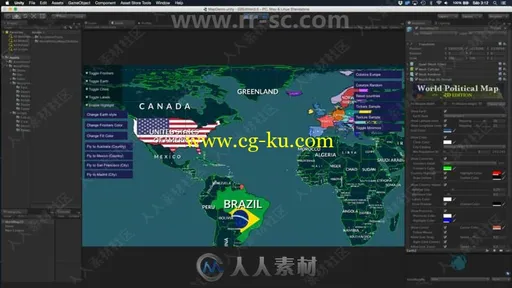
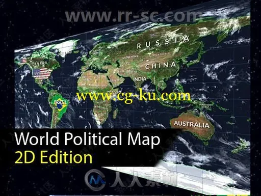
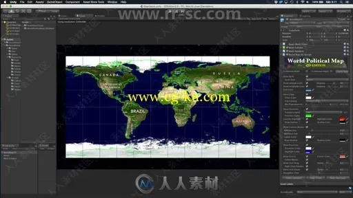
World Political Map - 2D Edition adds to your scene a beautiful, customizable and interactive 2D political map with just a couple of clicks. Drag the map prefab to your scene and customize the look & feel.
Key Features:
* Procedurally draws the frontiers of 241 countries, 4112 provinces and states, and the location of the 7144 most populated cities in the world!
* Fully interactive map: zoom, pan, select, regions of countries, provinces/states and cities highlight as you pass the mouse over them.
* Viewport rendering targets (supports cropping, see video below for a demo)
* Supports Perspective and Orthographic projections
* Add markers and line animations over any country, province, city or custom location using latitude/longitude
* Can be instantiated and controlled by code (API and documentation provided).
Custom editor inspector with 4 extra awesome components:
* Calculator: unit converter from lat/lon to XY coordinates and city distance calculator.
* Tickers: scrolling, blinking and fading messages.
* Decorator: customize countries appearance (colors, textures, labels).
* Map Editor: build the map you need from inside the Unity Editor with advanced tools (create/modify/reshape/merge countries, provinces, cities...)
Additional Features:
- Three types of cities, including country and region capitals.
- Automatically draws country labels with placement options.
- Colorize countries, provinces/states or entire continents!
- Per country texture support!
- Find and fly smoothly to any country, state or city by its name from current position. Also locate/fly to any location in the map by latitude/longitude.
- Mount Points: add your custom strategic locations from the Editor and find/navigate/position objects on them easily.
- Two levels of details for frontiers at 110.00.000:1 and 30.000.000:1 scale.
- Imaginary lines: draw latitude, longitude and cursor lines.
- Lots of customization options: frontiers colors, highlight color, visibility of cities/frontiers/Earth, labels, ...
- 8 Earth styles from lightweight styles to advanced styles including Scenic shaders (clouds + relief effects) and high resolution textures up to 16K with custom shaders.
- No internet access required! Geographic data included in the asset, which does not use Google Maps nor any other map provider. Makes it very fast and works offline!


发布日期: 2018-8-29